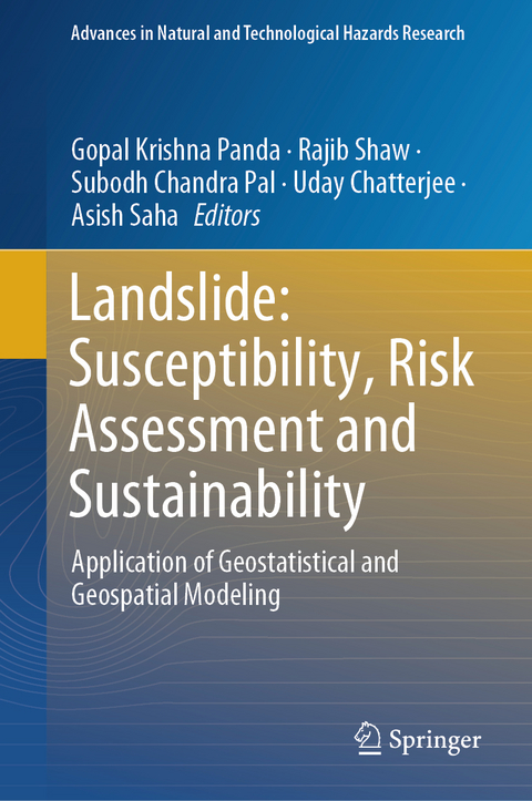
Landslide: Susceptibility, Risk Assessment and Sustainability
Springer International Publishing (Verlag)
978-3-031-56590-8 (ISBN)
The book illustrates a geospatial and geostatistical approach to data analysis, modeling, risk assessment, and visualization, as well as landslide hazard management in the hilly region. This book investigates cutting-edge methodologies based on open source software and R statistical programming and modeling in current decision-making procedures, with a particular emphasis on recent advances in data mining techniques and robust modeling in torrential rainfall and earthquake induced landslide hazard.
Dr. Rajib Shaw is a professor in the Graduate School of Media and Governance in Keio University, Japan. He is also the Senior Fellow of Institute of Global Environmental Strategies (IGES) Japan, and the Chairperson of SEEDS Asia and CWS Japan, two Japanese NGOs. Earlier, he was the Executive Director of the Integrated Research on Disaster Risk (IRDR) and was a Professor in Kyoto University. His expertise includes disaster governance, community-based disaster risk management, climate change adaptation, urban risk management, and disaster and environmental education. Professor Shaw is the Chair of the United Nations Science Technology Advisory Group (STAG) for disaster risk reduction; and also, the Co-chair of the Asia Science Technology Academic Advisory Group (ASTAAG). He is also the CLA (Coordinating Lead Author) for Asia chapter of IPCC's 6th Assessment Report. He is the editor-in-chief of the Elsevier's journal "Progress in Disaster Science", and series editor of a Springer book series on disaster risk reduction. Prof. Shaw has published more than 45 books and over 300 academic papers and book chapters.
Dr. Subodh Chandra Pal, Assistant Professor has been working in the Postgraduate Department of Geography, The University of Burdwan, Purba Bardhaman, West Bengal, India. He received his Ph.D. in Geography from Visva-Bharati (Central University in India) in 2015. His main fields of expertise are fluvial geomorphology, pedo-geomorphology, land degradation, soil erosion, gully erosion, landslide vulnerability, climate change, water resources monitoring and management and published nearly two hundred international and national research articles in various renowned journals (Springer, Elsevier, Taylor & Francis group, Wiley, MDPI and Nature Publishing group.). He published one author book from Springer Nature publishing house on Climate Change Impact on Soil Erosion in Sub-tropical Environment: Application of Empirical and Semi-empirical Models. He is the Editor of four running Edited books be published by Elsevier and Springer Publishing house. His research work has been funded by the University Grants Commission (UGC), Govt. of India and Department of Science and Technology (DST), Govt. of India. Dr. Pal has served as a reviewer for many International reputed journals. He is an Editorial board member of MDPI Water journal and Frontiers of Earth Science journal. Since 2022, Stanford University has recognized Dr. Pal as one of the world's top 2% scientists.
Dr. Uday Chatterjee is an Assistant Professor at the Department of Geography, Bhatter College, Dantan, Paschim Medinipur, West Bengal, India and an Applied Geographer with a Doctoral Degree in Applied Geography fron Ravenshaw Univ., Cuttack, Odisha, India. His areas of research interest cover Urban Planning, Social and Human geography, Applied Geomorphology, Hazards & Disasters, Environmental Issues, disaster governance, community-based disaster risk management, climate change adaptation, urban risk management, and disaster. He has delivered 10 invited lectures in Univ. Grants Commissions (UGC) sponsored national seminars and various academic forums of different colleges in India. In addition, he presented 20 papers in national and international seminars/conferences held in India as well as chaired and co-chaired more than 5 technical sessions. He has successfully guided project dissertations to undergraduate students. He has also conducted (Convener) one Faculty Development Programme on 'Modern methods of teaching and advanced research methods' sponsored by Indian Council of Social Science Research (ICSSR), Govt. of India. Currently, he has completed the Special Issue (S.I) of Urbanism, Smart Cities and Modeling, Geojournal, Springer as a Lead Editor, book series editor of Development in Environmental Science, Elsevier. His research work has been funded by the&
Chapter 1. Landslide Risk and Vulnerability; Real issues, Thoughts and Perspectives.- Chapter 2. Landslide Susceptibility Mapping by Using Geospatial Technique: Reference from Hofu City, Yamaguchi Prefecture, Japan.- Chapter 3. Landslide hazard risk and vulnerability monitoring - GIS based Approach.- Chapter 4. Landslide Susceptibility Mapping Methods - A Review.- Chapter 5. Mapping of Landslide Susceptibility using state-of-the-art method and Geospatial Techniques in the Rangamati District in the Chattogram Hill Tracts region of Bangladesh.- Chapter 6. Towards Artificially Intelligent Landslide Susceptibility Mapping: A Critical Review and Open Questions.- Chapter 7.Landslide Susceptibility Analysis by Frequency Ratio Model and Analytical Hierarchical Process in Mirik and Kurseong, Darjeeling Himalaya, India.- Chapter 8.Suitability analysis of landslide susceptibility model of Uttarkashi District in Uttarakhand, India: a comparative approach between weighted overlay and multi-criteria decision analysis.- Chapter 9. Determining Land induced factors for landslide susceptibility in Indian cities.- Chapter 10.Moisture-Driven Landslides and Cascade Hazards in the Himalayan Region: A Synthesis on Predictive Assessment.- Chapter 11. Landslide susceptibility map showing the spatial relationship between various landslide factors and landslide using remote sensing and GIS-based Frequency Ratio method in Chamoli district, Uttarakhand, India.- Chapter 12. Landslide susceptibility using weighted regression model: A Geo-spatial approach.- Chapter 13. Assessment of climate change impact on landslides in Darjeeling district of West Bengal: a geospatial, geostatistical and ecosystem service based approach.-Chapter 14. Landslide vulnerability analysis of tourist spots through Shannon Entropy model : A case study on Rudraprayag, Uttarakhand.- Chapter 15. Landslide Hazard Susceptibility Analysis and Modelling in the Vicinity of the Proposed Subansiri Lower HE Project, Arunachal Pradesh.-Chapter 16. Land Use and Land Cover as a Conditioning Factor in Landslide Susceptibility: A Literature Review.- Chapter 17. A Geospatial Review Analysis of Increased Frequency of Large Glacier-Related Landslides in Mountainous Regions.- Chapter 18. Landslide Detection Using DInSAR Technique: A Case Study.- Chapter 19. Landslide Hazard Risk Assessment Using GIS and Analytical Hierarchy Process (AHP) Approach: Evidence from 2017 Rangamati Hill Tracts Landslide Event, Bangladesh.- Chapter 20. Landslide risk assessment, awareness, and risk mitigation: case studies and major insights.- Chapter 21. Community-based Landslide Disaster Mitigation on The Northern Slope of "Telaga Lele" Hill, Banjarnegara Regency, Indonesia.- Chapter 22. Evaluation of Double Fusion Satellite Rainfall Dataset in Establish Rainfall Thresholds for Landslide Occurrences over Badung regency - Bali.- Chapter 23. Landslide Susceptibility and Risk Assessment in Hilly Regions of Bangladesh: A Geostatistical and Geospatial Modeling Approach for Sustainability.- Chapter 24. Landslide Hazard and Risk Management Framework for Alaknanda Basin in the Indian Himalayan Region.
| Erscheinungsdatum | 16.05.2024 |
|---|---|
| Reihe/Serie | Advances in Natural and Technological Hazards Research |
| Zusatzinfo | XXIV, 712 p. 244 illus., 225 illus. in color. |
| Verlagsort | Cham |
| Sprache | englisch |
| Maße | 155 x 235 mm |
| Themenwelt | Mathematik / Informatik ► Mathematik |
| Naturwissenschaften ► Biologie ► Ökologie / Naturschutz | |
| Naturwissenschaften ► Geowissenschaften ► Geografie / Kartografie | |
| Naturwissenschaften ► Geowissenschaften ► Geologie | |
| Schlagworte | Climatically Triggered Landslide • disaster risk reduction • Landslide Hazard Management • Rockfalls in High-Density Urban Environments • Sub-Surface Hydrology |
| ISBN-10 | 3-031-56590-8 / 3031565908 |
| ISBN-13 | 978-3-031-56590-8 / 9783031565908 |
| Zustand | Neuware |
| Haben Sie eine Frage zum Produkt? |
aus dem Bereich


