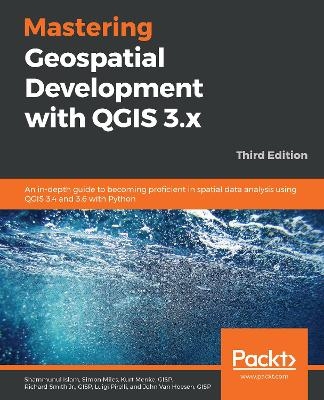
Mastering Geospatial Development with QGIS 3.x
Packt Publishing Limited (Verlag)
978-1-78899-989-2 (ISBN)
Go beyond the basics and unleash the full power of QGIS 3.4 and 3.6 with practical, step-by-step examples
Key Features
One-stop solution to all of your GIS needs
Master QGIS by learning about database integration, and geoprocessing tools
Learn about the new and updated Processing toolbox and perform spatial analysis
Book DescriptionQGIS is an open source solution to GIS and widely used by GIS professionals all over the world. It is the leading alternative to proprietary GIS software. Although QGIS is described as intuitive, it is also, by default, complex. Knowing which tools to use and how to apply them is essential to producing valuable deliverables on time.
Starting with a refresher on the QGIS basics and getting you acquainted with the latest QGIS 3.6 updates, this book will take you all the way through to teaching you how to create a spatial database and a GeoPackage. Next, you will learn how to style raster and vector data by choosing and managing different colors. The book will then focus on processing raster and vector data. You will be then taught advanced applications, such as creating and editing vector data. Along with that, you will also learn about the newly updated Processing Toolbox, which will help you develop the advanced data visualizations. The book will then explain to you the graphic modeler, how to create QGIS plugins with PyQGIS, and how to integrate Python analysis scripts with QGIS.
By the end of the book, you will understand how to work with all aspects of QGIS and will be ready to use it for any type of GIS work.
What you will learn
Create and manage a spatial database
Get to know advanced techniques to style GIS data
Prepare both vector and raster data for processing
Add heat maps, live layer effects, and labels to your maps
Master LAStools and GRASS integration with the Processing Toolbox
Edit and repair topological data errors
Automate workflows with batch processing and the QGIS Graphical Modeler
Integrate Python scripting into your data processing workflows
Develop your own QGIS plugins
Who this book is forIf you are a GIS professional, a consultant, a student, or perhaps a fast learner who wants to go beyond the basics of QGIS, then this book is for you. It will prepare you to realize the full potential of QGIS.
Shammunul Islam is a consulting spatial data scientist at the Institute of Remote Sensing, Jahangirnagar University, and a senior consultant at ERI, Bangladesh. He develops applications for automating geospatial and statistical analysis in different domains such as in the fields of the environment, climate, and socio-economy. He also consults as a survey statistician and provides corporate training on data science to businesses. He holds an MA in Climate and Society from Columbia University, an MA in development studies, and a BSc in statistics. Simon Miles is a GIS developer working for the Royal Borough of Windsor and Maidenhead, and has been working in the GIS industry since 2003. He always works using open source technologies. His main kit includes QGIS, PostGIS, Python, GDAL, Leaflet, JavaScript, and PHP. His main focus is on digital delivery/transformation, chiefly through the consolidation of data, applications, and legacy systems, and replacing these with APIs and web applications. In 2013, He helped to establish the UK QGIS user group, which holds regional meetings two or three times a year. Kurt Menke, GISP, a former Albuquerque, New Mexico, USA-based archaeologist, holds a masters in geography from the University of New Mexico. He is founded Bird's Eye View. He also focuses on public health and education. He is an avid GIS proponent since he began writing MapServer applications and has authored Discover QGIS. In 2015, Kurt was voted as an OSGeo Charter Member. He is a FOSS4G educator and co-authors the GeoAcademy. In 2015, he was awarded the Global Educator of the Year by GeoForAll as part of the GeoAcademy team. He authors an award-winning blog on FOSS4G technologies and their use in community health mapping. Richard Smith Jr., GISP, is an asst. professor of geographic information science in the School of Engineering and Computing Sciences at Texas A&M University, Corpus Christi. He has a Ph.D. in geography from the University of Georgia, MSc in computer science, and BSc in geographic information science from Texas A&M University, Corpus Christi. He researches in cartography, systems integration, and the use of geospatial technology for disaster response. He is an advocate for FOSS4G and building a FOSS4G curriculum. He is a co-author of the FOSS4G Academy. Luigi Pirelli is a QGIS developer and software analyst with a degree in computer science from Bari University. He has worked in the Satellite Ground Segment and Direct Ingestion for the European Space Agency. He is involved in GFOSS world, contributing in QGIS, GRASS, & MapServer core, and developing QGIS plugins. Luigi is the founder of the OSGEO Italian local GFOSS chapter. He has taught PyQGIS, delivered training from basic to advanced levels, and supported companies to develop their own QGIS plugins. He founded a local hackerspace group-Bricolabs.cc. He likes training groups on conflict resolution. He contributed to the Lonely Planet guide Cycling Italy. John Van Hoesen, GISP, is an associate professor of geology and environmental studies at Green Mountain College in rural west-central Vermont, USA. He has an MS and a Ph.D. in geology from the University of Nevada, Las Vegas. He is a certified GISP with a broad background in the geosciences and has used some flavor of GIS to evaluate and explore geological processes and environmental issues. John has taught graduate, undergraduate, and continuing education courses using some variants of FOSS GIS since 2003.
Table of Contents
What’s New in QGIS 3
Styling Raster and Vector Data
Creating Spatial Databases and Working with GeoPackages
Preparing Vector Data for Processing
Preparing Raster Data for Processing
Advanced Data Creation and Editing
Advanced Data Visualization
The Processing Toolbox
Automating Workflows with the Graphical Modeler
Creating QGIS Plugins with PyQGIS and Problem Solving
PyQGIS Scripting
| Erscheinungsdatum | 31.03.2019 |
|---|---|
| Verlagsort | Birmingham |
| Sprache | englisch |
| Maße | 75 x 93 mm |
| Themenwelt | Mathematik / Informatik ► Informatik ► Programmiersprachen / -werkzeuge |
| Informatik ► Software Entwicklung ► User Interfaces (HCI) | |
| ISBN-10 | 1-78899-989-4 / 1788999894 |
| ISBN-13 | 978-1-78899-989-2 / 9781788999892 |
| Zustand | Neuware |
| Informationen gemäß Produktsicherheitsverordnung (GPSR) | |
| Haben Sie eine Frage zum Produkt? |
aus dem Bereich


