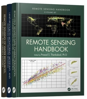
Remote Sensing Handbook - Three Volume Set
Crc Press Inc
978-1-4822-1801-5 (ISBN)
- Titel erscheint in neuer Auflage
- Artikel merken
A volume in the three-volume Remote Sensing Handbook series, Remote Sensing of Water Resources, Disasters, and Urban Studies documents the scientific and methodological advances that have taken place during the last 50 years. The other two volumes in the series are Remotely Sensed Data Characterization, Classification, and Accuracies, and Land Resources Monitoring, Modeling, and Mapping with Remote Sensing.
In true handbook style, this volume demonstrates in-depth, extensive and comprehensive coverage of Remote Sensing of Water Resources, Disasters, and Urban Studies. The book provides fundamental as well as practical knowledge of remote sensing of myriad topics pertaining to water resources, disasters, and urban areas such as hydrology, water resources, water use, water productivity, floods, wetlands, snow and ice, nightlights, geomorphology, droughts and drylands, disasters, volcanoes, fire, and smart cities.
Highlights include:
Hydrological studies, groundwater studies, flood studies, and crop water use and water productivity studies
Wetland modeling, mapping, and characterization
Snow and ice studies
Drought and dryland monitoring and mapping methods
Volcanoes, coal fires, and greenhouse gas emissions
Urban remote sensing for disaster risk management
Remote sensing for the design of smart cities
Considered magnum opus on the subject the three-volume Remote Sensing Handbook is edited by Dr. Prasad S. Thenkabail, an internationally acclaimed scientist in remote sensing, GIScience, and spatial sciences. The volume has contributions from pioneering remote sensing global experts on specific topics. The volume gives you a knowledge base on each of the above mentioned topics, a deep understanding the evolution remote sensing science, and familiarity with state-of-the-art of technology as well as a future vision for the field.
Dr. Prasad S. Thenkabail is a well known global expert in remote sensing and spatial sciences. Currently, works as a Research Geographer-15 with the U.S. Geological Survey (USGS). Dr. Thenkabail has conducted pioneering scientific research work in two major areas: Hyperspectral remote sensing of vegetation; Global Irrigated and Rainfed Cropland Mapping. His research papers have won three American Society of Photogrammetric Engineering and Remote Sensing (ASPRS) awards: (a) 2015 ERDAS award for best scientific paper (second author), (a) 2008 ASPRS President’s award (first author), (b) 1994 Autometric Award (first author). He is the Editor-in- Chief of seminal books (Publisher: Taylor and Francis Inc.): (a) three volume (including this), 82 Chapter, Remote Sensing Handbook (November 2015), (b) Hyperspectral Remote Sensing of Vegetation (2012), and (c) Remote Sensing of Global Croplands for Food Security (2009). He is the Editor-in-Chief of Remote Sensing Open Access Journal and is on the editorial board of Remote Sensing of Environment, and ISPRS Journal of Photogrammetry and Remote Sensing. Prasad has work experience in 25+ Countries including working in key remote sensing research/leadership positions @ the International Water Management Institute (IWMI), International Institute of Tropical Agriculture (IITA), Yale Center for Earth Observation (YCEO), and the Indian National Remote Sensing Agency. He was selected by NASA and USGS as a member of Landsat Science Team Member (2007-20011), and was a scientific advisory board member of Rapideye (2001). John G. Lyon has conducted scientific and engineering research and administrative functions throughout his career. He is formerly the senior physical scientist in the U.S. Environmental Protection Agency’s Office of Research and Development (ORD) and Office of the Science Advisor in Washington, DC, where he co-led work on the Group on Earth Observations and the USGEO subcommittee of the Committee on Environment and Natural Resources, and research on geospatial issues. Lyon was director of ORD’s Environmental Sciences Division for approximately eight years. He was educated at Reed College in Portland, Oregon, and the University of Michigan in Ann Arbor.
Foreword, Editor, Contributors, Section I:?Hydrology and Water Resources, 1. Remote Sensing Technologies for Multiscale Hydrological Studies: Advances and Perspectives, 2. Groundwater Targeting Using Remote Sensing, Section II:?Water Use and Water Productivity, 3. Remote Sensing of Actual Evapotranspiration from Croplands, 4. Water Productivity Studies from Earth Observation Data: Characterization, Modeling, and Mapping Water Use and Water Productivity, Section III:?Floods, 5. Flood Monitoring Using the Integration of Remote Sensing and Complementary Techniques, 6. Flood Studies Using Synthetic Aperture Radar Data, Section IV: Wetlands, 7. Remote Sensing of Mangrove Wetlands, 8. Wetland Mapping Methods and Techniques Using Multisensor, Multiresolution Remote Sensing: Successes and Challenges, 9. Inland Valley Wetland Cultivation and Preservation for Africa’s Green and Blue Revolution Using Multisensor Remote Sensing, Section V: Snow and Ice, 10. Remote Sensing Mapping and Modeling of Snow Cover Parameters and Applications, Section VI:?Nightlights, 11. Nighttime Light Remote Sensing: Monitoring Human Societies from Outer Space, Section VII:?Geomorphology, 12. Geomorphological Studies from Remote Sensing, Section VIII:?Droughts and Drylands, 13. Agricultural Drought Detection and Monitoring Using Vegetation Health Methods, 14. Agricultural Drought Monitoring Using Space-Derived Vegetation and Biophysical Products: A Global Perspective, 15. Remote Sensing of Drought: Emergence of a Satellite-Based Monitoring Toolkit for the United States, 16. Regional Drought Monitoring Based on Multisensor Remote Sensing, 17. Land Degradation Assessment and Monitoring of Drylands, Section IX: Disasters, 18. Disasters: Risk Assessment, Management, and Post-Disaster Studies Using Remote Sensing, 19. Humanitarian Emergencies: Causes, Traits, and Impacts as Observed by Remote Sensing, Section X: Volcanoes, 20. Remote Sensing of Volcanoes, Section XI:?Fires, 21. Satellite-Derived Nitrogen Dioxide Variations from Biomass Burning in a Subtropical Evergreen Forest, Northeast India, 22. Remote Sensing–Based Mapping and Monitoring of Coal Fires, Section XII:?Urban Areas, 23. Urban Growth Mapping of Mega Cities: Multisensor Approach, 24. Latest High-Resolution Remote Sensing and Visibility Analysis for Smart Environment Design, Section XIII:?Summary, 25. Remote Sensing of Water Resources, Disasters, and Urban Areas: Monitoring, Modeling, and Mapping Advances over the Last 50 Years and a Vision for the Future
| Reihe/Serie | Remote Sensing Handbook |
|---|---|
| Zusatzinfo | 321 Tables, black and white; 942 Illustrations, color |
| Verlagsort | Bosa Roca |
| Sprache | englisch |
| Maße | 210 x 280 mm |
| Gewicht | 7574 g |
| Themenwelt | Informatik ► Grafik / Design ► Digitale Bildverarbeitung |
| Naturwissenschaften ► Geowissenschaften ► Geografie / Kartografie | |
| Technik ► Umwelttechnik / Biotechnologie | |
| ISBN-10 | 1-4822-1801-1 / 1482218011 |
| ISBN-13 | 978-1-4822-1801-5 / 9781482218015 |
| Zustand | Neuware |
| Informationen gemäß Produktsicherheitsverordnung (GPSR) | |
| Haben Sie eine Frage zum Produkt? |
