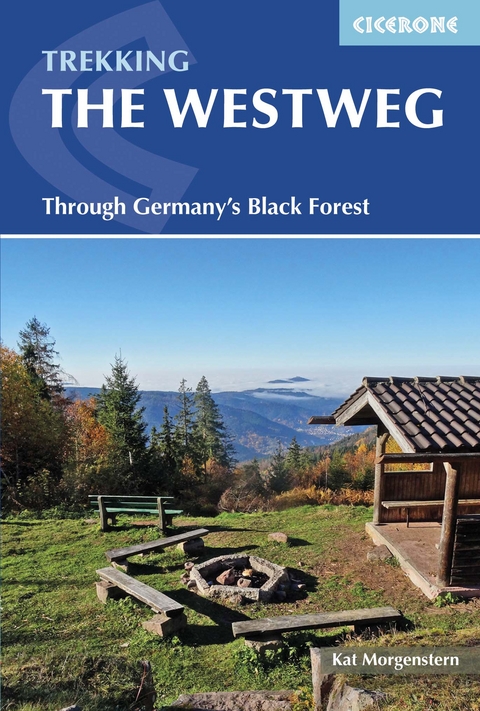
The Westweg
Cicerone Press (Verlag)
978-1-85284-775-3 (ISBN)
A guidebook to walking the Westweg (Westway) between Pfozheim in Germany to Basel in Switzerland. Covering 285km (177 miles), this long-distance trek through the Black Forest takes around 2 weeks and is suitable for any reasonably fit walker.
The route is described north to south in 13 stages, each between 15 and 28km (9–17 miles) in length. Two variants between Titisee and Basel are described, the western route takes in Feldberg, the Black Forest’s highest peak, whilst the quieter eastern route summits the Herzogenhorn peak.
1:100,000 mapping plus larger-scale town maps for key locations
GPX files available to download
Detailed information about refreshments and facilities along the route
Advice on planning and preparation
Born and raised in Berlin, Kat Morgenstern is a grassroots herbalist, ethnobotanist, writer and ecotravel professional. She has spent most of her adult life in the UK, US and France but currently lives in Germany's southern Black Forest, where she loves to roam the hills and forests.
Overview map
Transport map
Introduction
The Westweg
Geology
History
Plants and wildlife
Bannwald
Walking the Westweg
Getting there
Getting around
Walking without luggage
Where to stay
First and last nights
Food and drink
Dangers and annoyances
When to go
Equipment
Maps, navigation and GPS
Trail etiquette
Language
Telecommunications
Health and insurance
Money matters
Tourist information
Using this guide
Pforzheim to Hausach
Stage 1 Pforzheim to Dobel
Stage 2 Dobel to Forbach
Stage 3 Forbach to Unterstmatt
Stage 4 Unterstmatt to Alexanderschanze
Stage 5 Alexanderschanze to Hark
Stage 6 Hark to Hausach
Hausach to Titisee
Stage 7 Hausach to Wilhelmshöhe
Stage 8 Wilhelmshöhe to Kalte Herberge
Stage 9 Kalte Herberge to Titisee
Western route: Titisee to Basel
Stage 10A Titisee to Notschrei
Stage 11A Notschrei to Haldenhof
Stage 12A Haldenhof to Kandern
Stage 13A Kandern to Basel
Eastern route: Titisee to Basel
Stage 10B Titisee to Feldberg
Stage 11B Feldberg to Weißenbachsattel
Stage 12B Weißenbachsattel to Hasel
Stage 13B Hasel to Degerfelden
Stage 14B Degerfelden to Basel
Appendix A Route summary table
Appendix B Accommodation
Appendix C Further information
Appendix D German-English glossary
| Erscheint lt. Verlag | 7.11.2016 |
|---|---|
| Reihe/Serie | Cicerone guidebooks |
| Verlagsort | Kendal |
| Sprache | englisch |
| Maße | 116 x 172 mm |
| Gewicht | 250 g |
| Themenwelt | Sachbuch/Ratgeber ► Sport |
| Reisen ► Reiseführer ► Deutschland | |
| Reisen ► Sport- / Aktivreisen ► Deutschland | |
| Geisteswissenschaften ► Religion / Theologie | |
| ISBN-10 | 1-85284-775-1 / 1852847751 |
| ISBN-13 | 978-1-85284-775-3 / 9781852847753 |
| Zustand | Neuware |
| Haben Sie eine Frage zum Produkt? |
aus dem Bereich
