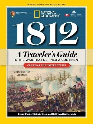
1812
A Traveler's Guide to the War That Defined a Continent
Seiten
2013
National Geographic Society (Verlag)
978-1-4262-1127-0 (ISBN)
National Geographic Society (Verlag)
978-1-4262-1127-0 (ISBN)
- Keine Verlagsinformationen verfügbar
- Artikel merken
This official guide to the War of 1812 takes readers on a fascinating tour of the prominent historical sites in both Canada and the U.S.
This guide is published in partnership with the U.S. National Park Service and Parks Canada, and is ideal for travelers who love history. Relive the epic battles of the War of 1812, from Fort McHenry - where Francis Scott Key was inspired to pen "The Star Spangled Banner" - to Tippecanoe, Queenston Heights, Horseshoe Bend, and Chalmette. This lushly illustrated, handy guidebook - the only one that contains both U.S. and Canadian sites - is the official U.S. National Park Service and Parks Canada guide to the War of 1812. It takes you to all war-related landmarks - from the shores of the Great Lakes, up and down the Eastern Seaboard, all the way south to New Orleans - and to such renowned attractions as the USS Constitution, Governors Island, and the White House, infamously torched in 1814 during the Chesapeake Campaign. Evocative text explains how the war played out, as well as tourist insights and how to visit each site. Fun, fact-filled sidebars; a milestones timeline, key biographical sketches; detailed visitor information; and colorful, easy-to-read maps make this a must-have souvenir for anyone joining in the bicentennial festivities and interested in the War of 1812.
This guide is published in partnership with the U.S. National Park Service and Parks Canada, and is ideal for travelers who love history. Relive the epic battles of the War of 1812, from Fort McHenry - where Francis Scott Key was inspired to pen "The Star Spangled Banner" - to Tippecanoe, Queenston Heights, Horseshoe Bend, and Chalmette. This lushly illustrated, handy guidebook - the only one that contains both U.S. and Canadian sites - is the official U.S. National Park Service and Parks Canada guide to the War of 1812. It takes you to all war-related landmarks - from the shores of the Great Lakes, up and down the Eastern Seaboard, all the way south to New Orleans - and to such renowned attractions as the USS Constitution, Governors Island, and the White House, infamously torched in 1814 during the Chesapeake Campaign. Evocative text explains how the war played out, as well as tourist insights and how to visit each site. Fun, fact-filled sidebars; a milestones timeline, key biographical sketches; detailed visitor information; and colorful, easy-to-read maps make this a must-have souvenir for anyone joining in the bicentennial festivities and interested in the War of 1812.
National Geographic cartographers create award-winning maps using state-of-the-art software for cartography and Geographic Information Systems (GIS). The results are clear, detailed maps that make map reading fun and informative.
| Verlagsort | Hanover, PA |
|---|---|
| Sprache | englisch |
| Maße | 134 x 181 mm |
| Themenwelt | Reiseführer ► Nord- / Mittelamerika ► Kanada |
| Reiseführer ► Nord- / Mittelamerika ► USA | |
| Geschichte ► Allgemeine Geschichte ► Neuzeit (bis 1918) | |
| Geisteswissenschaften ► Geschichte ► Regional- / Ländergeschichte | |
| ISBN-10 | 1-4262-1127-9 / 1426211279 |
| ISBN-13 | 978-1-4262-1127-0 / 9781426211270 |
| Zustand | Neuware |
| Haben Sie eine Frage zum Produkt? |
Mehr entdecken
aus dem Bereich
aus dem Bereich


