A Visual Cruising Guide to the Maine Coast
Seiten
2006
International Marine Publishing Co (Verlag)
978-0-07-145328-8 (ISBN)
International Marine Publishing Co (Verlag)
978-0-07-145328-8 (ISBN)
- Titel z.Zt. nicht lieferbar
- Versandkostenfrei innerhalb Deutschlands
- Auch auf Rechnung
- Verfügbarkeit in der Filiale vor Ort prüfen
- Artikel merken
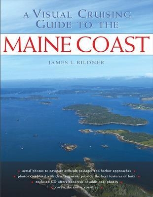
Takes the guesswork out of navigating Maine's intricate, reef-strewn waters. This guide contains aerial photographs that provide "by-the-picture" navigational guidance for Maine's harbors. It also includes: text descriptions of area with piloting instructions; labeled approach lines; and chart segments from high resolution NOAA charts.
WHEN YOU NAVIGATE THE COAST OF MAINE, A PICTURE IS WORTH A THOUSAND WORDSA Visual Cruising Guide to the Maine Coast takes the guesswork out of navigating Maine’s intricate, reef-strewn waters, ensuring that your next voyage through this coastal paradise will be picture-perfect.
Inside you will find more than 180 full-color aerial photographs that provide "by-the-picture” navigational guidance for Maine’s treasured harbors, difficult passages, and hidden approaches. Author James Bildner has added chart segments and recommended course lines to these low-altitude photos, giving you a unique, at-a-glance guide to sailing around Maine. It’s like cruising with a masthead lookout to point the way.
• Text descriptions of area with piloting instructions
• Labeled approach lines
• Low-angled photos with key navigation aides labeled
• Chart segments from high resolution NOAA charts
James L. Bildner is a life-long sailor and avid recreational pilot who shoots the photos for his books from his own helicopter. He owns a chain of upscale gourmet food stores in the greater Boston area and cruises the New England coast in his 52-foot Hinckley, Windward. A member of the Cruising Club of America, Jim has pulled together a network of local contributors to vet and detail the piloting instructions in this book. Jim is also the founder of the Literary Ventures Fund, a nonprofit with offices in Boston and New York, which invests marketing/promotion funds with commercial publishers to help exceptional works of fiction, literary nonfiction, and poetry find the audience they deserve. Hometown: Marblehead, MA
| Erscheint lt. Verlag | 16.6.2006 |
|---|---|
| Zusatzinfo | 300 Illustrations |
| Verlagsort | Rockport, ME |
| Sprache | englisch |
| Maße | 213 x 274 mm |
| Gewicht | 572 g |
| Themenwelt | Sachbuch/Ratgeber ► Sport ► Segeln / Tauchen / Wassersport |
| Technik ► Fahrzeugbau / Schiffbau | |
| ISBN-10 | 0-07-145328-8 / 0071453288 |
| ISBN-13 | 978-0-07-145328-8 / 9780071453288 |
| Zustand | Neuware |
| Haben Sie eine Frage zum Produkt? |
Mehr entdecken
aus dem Bereich
aus dem Bereich
Buch | Spiralbindung (2023)
Stadler Konstanz (Verlag)
22,00 €
Buch | Hardcover (2023)
Delius Klasing (Verlag)
49,90 €


