Territorial Imaginaries
University of Chicago Press (Verlag)
978-0-226-83900-4 (ISBN)
- Noch nicht erschienen (ca. April 2025)
- Versandkostenfrei innerhalb Deutschlands
- Auch auf Rechnung
- Verfügbarkeit in der Filiale vor Ort prüfen
- Artikel merken
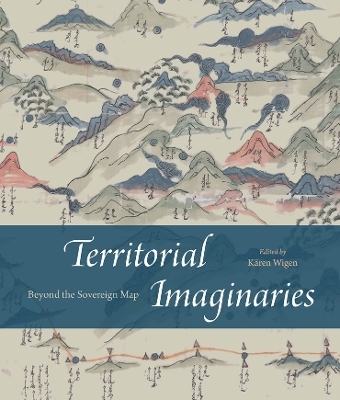
This strikingly colorful volume contends that modern mapping has never been sufficient to illustrate the complex reality of territory and political sovereignty, whether past or present. For Territorial Imaginaries, editor Kären Wigen has assembled an impressive slate of experts, spanning disciplines as far apart as political science and art history, to contribute perspectives and case studies covering three main themes: mapping before the nation-state, rethinking and critiquing mapping practices, and robust traditions of counter-cartography.
Each contributor proposes alternative ways to map, supporting their essays with rich archival documentation. Among the far-reaching case studies are Barbara Mundy’s cartographic history of Indigenous dispossession in the Americas, Peter Bol’s examination of two Chinese maps created five hundred years apart, and Ali Yaycıoğlu’s exploration of tensions between top-down and bottom-up mapping of Habsburg and Ottoman border claims.
Kären Wigen is the Frances and Charles Field Professor in History at Stanford University.
Foreword
Introduction
Kären Wigen
Part I. Mapping Practices before the Nation-State
1. Ambiguous Territories: Mapping Siberia in the Era of Peter the Great
Valerie Kivelson
2. From People to Territory: (The Chinggisid) Sovereignty Transformed?
Lhamsuren Munkh-Erdene
3. Maps for Failed States
Peter K. Bol
4. On the Ottoman Arguments during the Congress of Karlowitz (1699)
Ali Yaycıoğlu
Part II. Pushing Back against the Sovereign Map
5. Territorial Challenges at Interstate Borders: Where and How History Matters
Alexander B. Murphy and Cy Abbott
6. Reconceptualizing the State and Its Alternatives: Ideas, Infrastructures, Representations
Jordan Branch
7. Voluminous, Scattered, Distorted: On the Limits of Cartographic Representations
Franck Billé
Part III. From Critique to Counter-Cartography
8. Indigenous Sovereignty Out of Time
Barbara E. Mundy
9. Erasing the Other: Maps, Bordering, and Political Power
Guntram Herb
10. Visualizing Shared Dominion in the Holy Roman Empire: Dilution, Orientation, Oscillation
Luca Scholz
Notes
List of Contributors
Index
| Erscheint lt. Verlag | 7.4.2025 |
|---|---|
| Zusatzinfo | 51 color plates |
| Sprache | englisch |
| Maße | 210 x 254 mm |
| Gewicht | 454 g |
| Themenwelt | Geisteswissenschaften ► Geschichte ► Teilgebiete der Geschichte |
| Naturwissenschaften ► Geowissenschaften ► Geografie / Kartografie | |
| Technik ► Maschinenbau | |
| ISBN-10 | 0-226-83900-1 / 0226839001 |
| ISBN-13 | 978-0-226-83900-4 / 9780226839004 |
| Zustand | Neuware |
| Haben Sie eine Frage zum Produkt? |
aus dem Bereich


