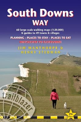
South Downs Way (Trailblazer British Walking Guides)
Trailblazer Publications (Verlag)
978-1-912716-23-4 (ISBN)
- Titel ist leider vergriffen;
keine Neuauflage - Artikel merken
Practical, complete guide to walking the South Downs Way, a 100-mile National Trail footpath which follows the line of chalk hills stretching from Winchester to Eastbourne in southern England. Includes * 82 Maps: 60 large-scale walking maps - 1:20,000 (3-1/8 inches to 1 mile), 11 town plans, 10 stage maps with trail profiles showing hills and descents, and 2 overview maps. * Detailed accommodation with reviews: B&Bs, campsites, pubs, hotels, bunkhouses. * Where to eat with reviews: cafes, teashops, pubs, takeaways and restaurants. * Comprehensive public transport information with frequency of services for all access points on the Path. * Downloadable GPS waypoints. * Itineraries for all walkers, whether hiking the entire route or sampling highlights on day walks, weekends or short breaks. * Unique mapping features - walking times, directions, tricky junctions, places to stay, places to eat, points of interest written onto the maps. * Flora and fauna - four page full colour flower guide, plus an illustrated section on local wildlife * Green hiking - understanding the local environment and minimizing our impact on it.
Henry Stedman is a walker of considerable experience, having hiked in many parts of Europe, Asia and Africa, and he has been writing guidebooks for more than 20 years. He's the author of five other guides from Trailblazer: Dales Way, Cleveland Way, Kilimanjaro, Dolomites Trekking, Coast to Coast Path, and co-author with Joel Newton of Exmoor & North Devon Coast Path, Dorset & South Devon Coast Path and Cornwall Coast Path.
INTRODUCTION
About the South Downs Way
History 9 - How difficult is the path? 10 - How long do you need? 12 When to go 12 - Seasons 13 - Festivals and annual events 14 Temperature 16 - Rainfall 16 - Daylight hours 16
PART 1: PLANNING YOUR WALK
Practical information for the walker
Route finding 17 - Accommodation 18 - Food and drink 21
Money 23 - Information for foreign visitors 24 - Other services 25 - Walking companies and baggage transfer 26 - Mountain biking 27
Taking dogs along the Way 28 - Disabled access 28
Budgeting 28
Itineraries
Town and village facilities 30 - Which direction? 32 - Suggested itineraries 33 - Day and weekend walks 34
What to take
Keep your luggage light 35 - How to carry it 35 - Footwear 36
Clothes 37 - Toiletries 38 - First-aid kit 38 - General items 38
Camping gear 39 - Money 39 - Maps 39 - Sources of further
information 40 - Recommended reading 41
Getting to and from the South Downs Way
Getting to Britain 42 - National transport 42 - Local transport 44
Public transport map 45 - Public transport services 46
PART 2: THE ENVIRONMENT AND NATURE
Flora and fauna
Butterflies 48 - Flowers 49 - Trees 51 - Mammals 52 - Reptiles 52
Birds 53 - Geology 54
Conservation of the South Downs
Government agencies and schemes 57 - Campaigning and
conservation organisations 58
PART 3: MINIMUM IMPACT WALKING AND OUTDOOR SAFETY
Minimum impact walking
Economic impact 60 - Environmental impact 61 - Access 63
The Countryside Code 64
Outdoor safety and health
Avoidance of hazards 66 - Footcare 67 - Sunburn, Hypothermia and
Hyperthermia 67 - Weather forecasts 68 - Dealing with an
accident 68
PART 4: ROUTE GUIDE AND MAPS
Using this guide 69
Winchester 71
Winchester to Exton 77
(Chilcomb 78, Cheriton 78, Exton 84)
Exton to Buriton 86
(East Meon 88, Buriton 93, Petersfield 93)
Buriton to Cocking 98
(South Harting 100, Cocking 102, Midhurst 104)
Cocking to Amberley 106
(Heyshott 106, Graffham 106, Sutton and Bignor 113, Bury 116,
Houghton Bridge 116, Amberley 118, Arundel 119)
Amberley to Steyning 123
(Storrington 125, Washington 128, Steyning 130, Bramber and
Upper Beeding 132)
Steyning to Pyecombe 134
(Truleigh Hill 137, Fulking 137, Poynings 137, Newtimber Hill 137, Pyecombe 140)
Pyecombe to Southease 140
(Clayton 142, Ditchling 142, Plumpton 144, Lewes 146, Between Lewes and Kingston-near-Lewes 152, Kingston-near-Lewes 152, Rodmell 155, Southease 158)
Southease to Alfriston 158
(West Firle 158, Alciston 161, Berwick 161, Alfriston 161)
Alfriston to Eastbourne (coastal route via Cuckmere) 165
(Litlington 165, Westdean and Exceat 166, Seven Sisters Country
Park 166, Birling Gap 170, Beachy Head 170, Meads 170)
Alfriston to Eastbourne (inland route via Jevington) 172
(Milton Street 172, Wilmington 172, Jevington 174)
Eastbourne 178
APPENDICES
A: GPS waypoints 183B: Distance chart 184
C: Taking a dog along the Way 188
MAP KEY 190
INDEX 191
OVERVIEW MAPS AND PROFILES 194
| Erscheinungsdatum | 06.04.2022 |
|---|---|
| Reihe/Serie | Trailblazer British Walking Guides |
| Überarbeitung | Henry Stedman |
| Zusatzinfo | 60 colour photos; 4pp colour flower guide; 60 trail maps & 11 town plans (black and white); 10 colour, stage maps and 2 colour, overview maps |
| Verlagsort | Hindhead, Surrey |
| Sprache | englisch |
| Maße | 120 x 180 mm |
| Themenwelt | Sachbuch/Ratgeber ► Sport |
| Reiseführer ► Europa ► Großbritannien | |
| ISBN-10 | 1-912716-23-2 / 1912716232 |
| ISBN-13 | 978-1-912716-23-4 / 9781912716234 |
| Zustand | Neuware |
| Haben Sie eine Frage zum Produkt? |
aus dem Bereich


