The Thames Path Map Booklet
Cicerone Press (Verlag)
978-1-85284-925-2 (ISBN)
- Titel ist leider vergriffen;
keine Neuauflage - Artikel merken
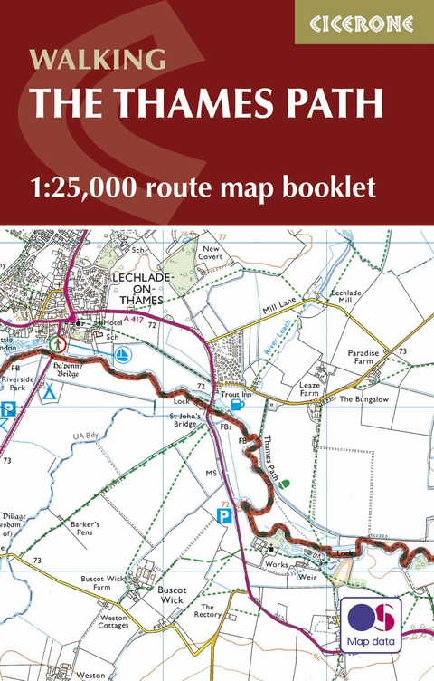
All the mapping you need to complete the 180 mile (288km) Thames Path National Trail, from London's Thames Barrier to the river's source in Gloucestershire. This booklet is included with the Cicerone guidebook to the Thames Path, where the route is divided into 20 stages, with each stage ranging from 4 to 16 miles. This gentle riverside walk takes roughly two weeks to complete.
This booklet of Ordnance Survey 1:25,000 Explorer maps has been designed for convenient use on the trail. It shows the full and up-to-date line of the National Trail, along with the relevant extract from the OS Explorer map legend. Conveniently sized for slipping into a jacket pocket or top of a rucksack, it comes in a clear PVC sleeve and provides all the mapping needed to complete the trail.
Passing through London, Windsor and Oxford as well as rural countryside, this National Trail offers walkers a diverse range of landscapes and scenery. With excellent public transport services at each stage, this trail can also be completed in bite-size pieces - why not relish the route over several weekends throughout the year and discover the many moods of the Thames with the passing seasons?
Leigh Hatts has been walking the Thames towpath and exploring the river and Docklands since 1981, when he worked on the feasibility study that resulted in the decision to establish the route as a National Trail. He worked as a reporter with the walkers' magazine TGO and as arts correspondent of the Catholic Herald. He is co-founder of Bankside Press.
The Thames Path
Map key
Contents and using this guide
Section 1 Thames Barrier to Tower Bridge
Section 2 Tower Bridge to Putney
Section 3 Putney to Kingston
Section 4 Kingston to Chertsey
Section 5 Chertsey to Staines
Section 6 Staines to Windsor
Section 7 Windsor to Maidenhead
Section 8 Maidenhead to Marlow
Section 9 Marlow to Henley
Section 10 Henley to Reading
Section 11 Reading to Pangbourne
Section 12 Pangbourne to Goring
Section 13 Goring to Wallingford
Section 14 Wallingford to Dorchester
Section 15 Dorchester to Abingdon
Section 16 Abingdon to Oxford
Section 17 Oxford to Newbridge
Section 18 Newbridge to Lechlade
Section 19 Lechlade to Cricklade
0
0
2016-01-08T12:01:00Z
1
98
560
Cicerone Press
4
1
657
14.0
Normal
0
false
false
false
EN-GB
JA
X-NONE
/* Style Definitions */
table.MsoNormalTable
{mso-style-name:"Table Normal";
mso-tstyle-rowband-size:0;
mso-tstyle-colband-size:0;
mso-style-noshow:yes;
mso-style-priority:99;
mso-style-parent:"";
mso-padding-alt:0cm 5.4pt 0cm 5.4pt;
mso-para-margin:0cm;
mso-para-margin-bottom:.0001pt;
mso-pagination:widow-orphan;
font-size:12.0pt;
font-family:Cambria;
mso-ascii-font-family:Cambria;
mso-ascii-theme-font:minor-latin;
mso-hansi-font-family:Cambria;
mso-hansi-theme-font:minor-latin;}
Section 20 Cricklade to Source
Extract from OS Explorer map legend
| Erscheinungsdatum | 21.04.2016 |
|---|---|
| Reihe/Serie | Cicerone guidebooks |
| Zusatzinfo | 88 pages of OS1:25.000 mapping |
| Verlagsort | Kendal |
| Sprache | englisch |
| Maße | 116 x 172 mm |
| Gewicht | 130 g |
| Themenwelt | Sachbuch/Ratgeber ► Sport |
| Reisen ► Karten / Stadtpläne / Atlanten ► Europa | |
| Reiseführer ► Europa ► Großbritannien | |
| ISBN-10 | 1-85284-925-8 / 1852849258 |
| ISBN-13 | 978-1-85284-925-2 / 9781852849252 |
| Zustand | Neuware |
| Haben Sie eine Frage zum Produkt? |
aus dem Bereich


