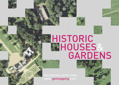
Historic Houses and Gardens
100 Amazing Views
Seiten
2001
HarperCollins Illustrated (Verlag)
978-0-00-711570-9 (ISBN)
HarperCollins Illustrated (Verlag)
978-0-00-711570-9 (ISBN)
- Titel ist leider vergriffen;
keine Neuauflage - Artikel merken
HISTORIC HOUSES & GARDENS is a compilation of 100 vertical aerial photographs of the most noteworthy British great houses and their grounds, taken from the Millennium Map.
St Michael's Mount, set atop a romantic Cornish island; Chequers in Buckinghamshire, the Prime Minister's residence; Chatsworth, Derbyshire seat of the Dukes of Devonshire; Levens Hall in Cumbria, best known for its bizarre topiary; Kensington Palace, for its royalty; Igtham Mote, a Kentish moated manor house; Abbotsford, home and inspiration of Sir Walter Scott… HISTORIC HOUSES & GARDENS brings a surprising new angle to places such as these, and many more.
ABOUT THE MILLENNIUM MAP
Still being created, the Millennium Map is a fascinating venture. Inspired by the Domesday Book, Tristram Cary and Joe Studholme of Getmapping.com commissioned four specially equipped aircraft to fly the length and breadth of the country in strips – rather like a lawnmower – each one carrying state-of-the-art camera equipment valued at £250,000. These planes are systematically taking vertical photographs of the whole of the United Kingdom from an average height of 5,500 feet, recording every object right down to a minimum size of 25cm.
So far over 30km of nine-inch-wide film has been taken. After processing, each photograph is scanned at high resolution, subsequently undergoing a process known as geo-correction, which removes distortions caused by the tilt of the aircraft and the contours of the ground; the individual files are then colour-balanced and spliced together to form a single map-accurate 'mosaic' of the entire country.
In what must be the ultimate endorsement of its national significance, Her Majesty the Queen is a private investor in The Millennium Map; and when completed, the map will provide a snapshot of life in the year 2000 as historically important as William the Conqueror's survey of 1086.
Getmapping.com plc was established in 1998 specifically to produce the first ever complete, full-colour, digital, photographic map of the UK. The Millennium Map, as it is known, has revolutionised the market by making high-quality aerial photography widely available to both the professional user and the general public, primarily through its website, www.getmapping.com.
| Erscheint lt. Verlag | 3.12.2001 |
|---|---|
| Zusatzinfo | (100+ colour illustrations) |
| Verlagsort | London |
| Sprache | englisch |
| Maße | 216 x 156 mm |
| Gewicht | 409 g |
| Themenwelt | Kunst / Musik / Theater ► Fotokunst |
| Sachbuch/Ratgeber ► Freizeit / Hobby ► Fotografieren / Filmen | |
| Reiseführer ► Europa ► Großbritannien | |
| Technik ► Architektur | |
| ISBN-10 | 0-00-711570-9 / 0007115709 |
| ISBN-13 | 978-0-00-711570-9 / 9780007115709 |
| Zustand | Neuware |
| Haben Sie eine Frage zum Produkt? |
Mehr entdecken
aus dem Bereich
aus dem Bereich
individuell reisen mit vielen praktischen Tipps
Buch | Softcover (2024)
Michael Müller (Verlag)
29,90 €
Reiseführer mit Stadtplan, 4 Spaziergängen und kostenloser Web-App
Buch | Softcover (2023)
Reise Know-How (Verlag)
15,95 €
Buch | Softcover (2023)
Reise Know-How (Verlag)
24,95 €


