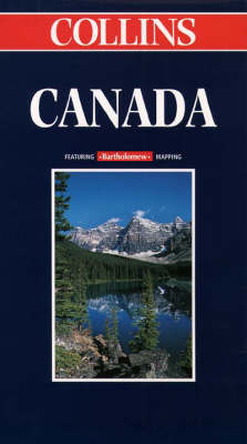
Canada
1999
|
New edition
Collins (Verlag)
978-0-00-448919-3 (ISBN)
Collins (Verlag)
978-0-00-448919-3 (ISBN)
- Titel erscheint in neuer Auflage
- Artikel merken
Zu diesem Artikel existiert eine Nachauflage
Revised editon in Collins brand for the first time. Map was previously published under Times and Bartholomew imprints. SCALE 1 : 5 800 000 1 cm to 58 km 1 inch to 92 miles
MAIN FEATURES
Politically coloured map highlighting the Canadian
Provinces and including the new Innuit province of
Nunavut.
INCLUDES
Cities and towns, roads, railways, international
and provincial boundaries, airports and National
Parks. Oil and gas pipelines, glaciers and
icecaps.
AREA OF COVERAGE
All of Canada from Ellesmere Island in the north to
the Great Lakes and the U.S.A. in the south, and
from Vancouver and Alaska in the west to
Newfoundland in the east. The map also extends
further to the east to include all of Greenland and
Iceland.
WHO THE PRODUCT IS AIMED AT
Home and business reference use and travel
planning
.
OTHER PRODUCTS IN THE SERIES
North America
USA
USA Western
USA Central
USA Eastern
Plus a range of individual country and country
group maps
| Erscheint lt. Verlag | 6.4.1999 |
|---|---|
| Reihe/Serie | World Travel Map |
| Verlagsort | London |
| Sprache | englisch |
| Maße | 1040 x 926 mm |
| Gewicht | 110 g |
| Themenwelt | Reisen ► Karten / Stadtpläne / Atlanten ► Europa |
| Reisen ► Karten / Stadtpläne / Atlanten ► Nord- / Mittelamerika | |
| ISBN-10 | 0-00-448919-5 / 0004489195 |
| ISBN-13 | 978-0-00-448919-3 / 9780004489193 |
| Zustand | Neuware |
| Haben Sie eine Frage zum Produkt? |
Mehr entdecken
aus dem Bereich
aus dem Bereich
Straßen- und Freizeitkarte 1:250.000
Karte (gefalzt) (2023)
Freytag-Berndt und ARTARIA (Verlag)
12,90 €
Karte (gefalzt) (2023)
Freytag-Berndt und ARTARIA (Verlag)
12,90 €
Östersund
Karte (gefalzt) (2023)
Freytag-Berndt und ARTARIA (Verlag)
12,90 €


