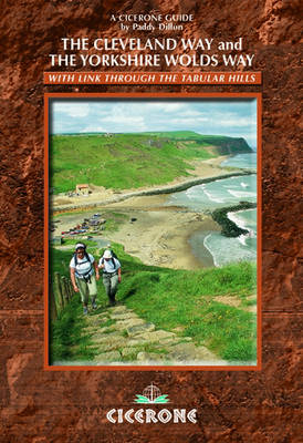
The Cleveland Way and the Yorkshire Wolds Way
Cicerone Press (Verlag)
978-1-85284-447-9 (ISBN)
- Titel ist leider vergriffen;
keine Neuauflage - Artikel merken
The Cleveland Way National Trail offers a fine 110 mile walk around the North York Moors National Park, enjoying scenery that includes the open heather moorlands, gentle dales, interesting towns and villages, and dramatic cliff coastline. The Tabular Hills Walk is a 50 mile Regional Trail between Scalby Mills, near Scarborough and Hemsley, far inland. Walkers can pick up the Cleveland Way at the market town of Hemsley and continue along this route back to Filey. The Yorkshire Wolds Way, one of the quietest of Britain's National Trails, wanders through gentle, cultivated and sparsely populated countryside. The route is usually walked from south to north for 80 miles from Hessle, near Hull on the Humber Estuary to Filey.
Paddy Dillon is a prolific outdoor writer with a score and more books to his name, as well as a dozen booklets and brochures. He writes for a number of outdoor magazines and other publications, as well as producing materials for tourism groups and other organisations. He lives on the fringe of the Lake District, and has walked, and written about walking, in every county in England, Scotland, Ireland and Wales.
The Yorkshire Wolds Way National Trail
Day 1 Hessle to South Cave
Day 2 South Cave to Goodmanham or Market Weighton
Day 3 Goodmanham or Market Weighton to Millington
Day 4 Millington to Thixendale
Day 5 Thixendale to Sherburn
Day 6 Sherburn to Filey
Day 7 Filey to Scalby Mills (via the Cleveland Way)
The Tabular Hills Walk
Day 1 Scalby Mills to Levisham
Day 2 Levisham to Hutton-le-Hole
Day 3 Hutton-le-Hole to Helmsley
The Cleveland Way National Trail
Day 1 Helmsley to Sutton Bank
Day 2 Sutton Bank to Osmotherley
Day 3 Osmotherley to Clay Bank
Day 4 Clay Bank to Kildale
Day 5 Kildale to Saltburn-by-the-Sea
Day 6 Saltburn-by-the-Sea to Sandsend
Day 7 Sandsend to Robin Hood's Bay
Day 8 Robin Hood's Bay to Scarborough
Day 9 Scarborough to Filey
| Erscheint lt. Verlag | 17.3.2010 |
|---|---|
| Zusatzinfo | 70 colour photos and 40 OS maps |
| Verlagsort | Kendal |
| Sprache | englisch |
| Maße | 116 x 172 mm |
| Gewicht | 230 g |
| Themenwelt | Sachbuch/Ratgeber ► Sport |
| Reiseführer ► Europa ► Großbritannien | |
| ISBN-10 | 1-85284-447-7 / 1852844477 |
| ISBN-13 | 978-1-85284-447-9 / 9781852844479 |
| Zustand | Neuware |
| Haben Sie eine Frage zum Produkt? |
aus dem Bereich


