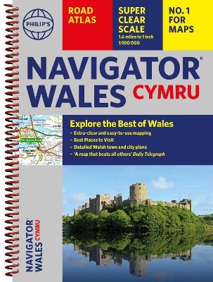
Philip's Navigator Wales
The Best Road Atlas for Wales Cymru
Seiten
2024
Philip's (Verlag)
978-1-84907-655-5 (ISBN)
Philip's (Verlag)
978-1-84907-655-5 (ISBN)
Explore the many attractions of Wales with this easy-to-use road atlas showing all the top spots. Easy-to-read mapping, superb extra detail, and a great lie-flat format make this the ultimate Welsh road trip companion.
Explore the many attractions of Wales with this easy-to-use road atlas and guide to the top spots from Philip's, the best-selling road atlas brand. With all you need for travelling in Wales: easy-to-read mapping, superb detail and top travel tips make this the ultimate road trip companion.
- Unrivalled level of detail from motorways to country lanes.
- Exceptional clarity at a scale of 1.6 miles to 1 inch (1:100,000).
- Ideal for explorers: heritage sites, spectacular sights, and the best walks around Snowdonia, the Brecon Beacons, the Pembrokeshire Coast and more.
- Tourist attractions and places of interest clearly highlighted, from Caernarfon Castle to St David's Cathedral.
- Indexed town plans for all major centres, including Aberystwyth, Bangor, Cardiff, Holyhead, Llandudno, Llanelli, Merthyr Tydfil, Newport, Newtown, Swansea, and Wrexham.
- Packed with hundreds of individually named farms, houses, and hamlets, alongside airports, airfields, stations, ferries, canals, and harbours.
- Key to map symbols are clearly indexed and shown in English and Welsh.
With its large scale and wealth of travel information, the Navigator atlas is perfect for both leisure and business.
Praise for The Philip's Navigator Series:
'Beats all others.' - The Daily Telegraph
'The reigning champion of Road Atlases.' - The Sunday Times
'Scale, accuracy, and clarity are without parallel.' - Driving Magazine
'No.1 in the UK for clear maps.' - Independent Research Survey
Philip's has been at the forefront of creating maps and atlases since 1834. Whether a local street map or a fact-packed World Atlas, we use the most up-to-date technology, expertise and our global network to ensure our customers have all the information they need.
| Erscheinungsdatum | 05.03.2024 |
|---|---|
| Reihe/Serie | Philip's Road Atlases |
| Verlagsort | London |
| Sprache | englisch |
| Maße | 216 x 296 mm |
| Gewicht | 340 g |
| Themenwelt | Reisen ► Karten / Stadtpläne / Atlanten ► Europa |
| Reiseführer ► Europa ► Großbritannien | |
| ISBN-10 | 1-84907-655-3 / 1849076553 |
| ISBN-13 | 978-1-84907-655-5 / 9781849076555 |
| Zustand | Neuware |
| Haben Sie eine Frage zum Produkt? |
Mehr entdecken
aus dem Bereich
aus dem Bereich
individuell reisen mit vielen praktischen Tipps
Buch | Softcover (2024)
Michael Müller (Verlag)
29,90 €
Reiseführer mit Stadtplan, 4 Spaziergängen und kostenloser Web-App
Buch | Softcover (2023)
Reise Know-How (Verlag)
15,95 €


