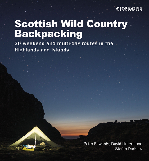
Scottish Wild Country Backpacking
Cicerone Press (Verlag)
978-1-85284-904-7 (ISBN)
A large-format guidebook to 29 short backpacking excursions of 2–4 days, plus one single-day route, in the Scottish Highlands and Islands. Perfect for a long weekend or short break, the routes cross rugged remote terrain, calling for good fitness, navigational skill and self-reliance.
Covering the Inner and Outer Hebrides and the northern half of Scotland, the routes range from 13 to 94km (8–58 miles). Many offer the option to stay in a bothy, although the majority require at least one night’s wild camping.
Clear route description illustrated with 1:100,000 mapping
GPX files available for download
Practical information for planning your trip, plus notes on history, geology, plants and wildlife
A list of the Munros and Corbetts visited on the routes
Inspirational colour photography
Originally from the Sussex coast, Peter Edwards lives in Rhenigidale on the Isle of Harris with his wife and their Labradors. David Lintern is an award-winning photographer and writer. He came late to the outdoors: he reached 'escape velocity' in his forties and now lives in Strath Spey with his young family. Stefan Durkacz cut his backpacking teeth in the Cairngorms and continues to explore far and wide throughout the Scottish hills. He lives in Edinburgh with his wife, two daughters and dog.
Map key
Overview map
Route summary table
Introduction
The Scottish Highlands
Wildness and wilderness in a Scottish context
Wildlife
Plants and flowers
Geology
Backpacking in the Highlands
Getting there
Getting around
Equipping for Scotland's backcountry
Using bothies
Backpacking with dogs
Environmental impact and Leave No Trace
Maps and route-finding
Safety and emergencies
Using this guide
Western Highlands and Inner Hebrides
Route 1 The Glen Etive Five
Route 2 Fort William to Glenfinnan via north Ardgour
Route 3 Streap and Braigh nan Uamhachan
Route 4 The west coast of Jura
Route 5 Around the coast of Rùm
Route 6 Isle of Skye: Glen Sligachan, Loch Coruisk and Camasunary
Central and Eastern Highlands
Route 7 Ben Alder: Tour of the ridges
Route 8 Blair Atholl to Kingussie
Route 9 The Mòine Mhòr Munros
Route 10 Ben Avon and Beinn a' Bhuird
Route 11 Northeast Cairngorms
Northwest Highlands
Route 12 Inverinate Forest and the Gates of Affric
Route 13 Affric Haute Route
Route 14 Killilan Forest: Sgùman Còinntich, Faochaig, and Aonach Buidhe
Route 15 The Applecross Peninsula: Sgùrr a' Chaorachain and Beinn Bh&##xe0;n
Route 16 Achnashellach, Bendronaig and West Monar
Route 17 Coulin Forest
Route 18 The Fannichs
Route 19 Fisherfield and Letterewe
Route 20 Flowerdale Three: Beinn Eoin, Beinn Dearg and Baosbheinn
The Far North
Route 21 The Postie's Path and the Coigach group
Route 22 Glencoul, Gleann Dubh and Beinn Leòid
Route 23 Ben Klibreck and the Ben Armine Forest
Route 24 Around Strath Dionard
Route 25 Cape Wrath, Sandwood Bay and the Parph
Outer Hebrides
Route 26 A circuit of Mingulay
Route 27 Hecla, Beinn Mhòr and South Uist's wild east coast
Route 28 Harris Hills, Loch R&##xe8;asort and Cravadale
Route 29 Isle of Lewis: Uig Hills and coast
Route 30 Isle of Lewis: Pairc Peninsula
Appendix A Table of Munros and Corbetts
Appendix B Glossary
Appendix C Further reading
| Erscheinungsdatum | 03.10.2022 |
|---|---|
| Reihe/Serie | Cicerone guidebooks |
| Zusatzinfo | 31 colour maps |
| Verlagsort | Kendal |
| Sprache | englisch |
| Maße | 220 x 240 mm |
| Gewicht | 890 g |
| Themenwelt | Sachbuch/Ratgeber ► Sport |
| Reiseführer ► Europa ► Großbritannien | |
| Reisen ► Sport- / Aktivreisen ► Europa | |
| ISBN-10 | 1-85284-904-5 / 1852849045 |
| ISBN-13 | 978-1-85284-904-7 / 9781852849047 |
| Zustand | Neuware |
| Haben Sie eine Frage zum Produkt? |
aus dem Bereich


