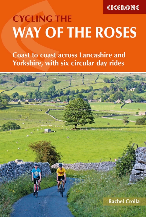
Cycling the Way of the Roses
Cicerone Press (Verlag)
978-1-85284-912-2 (ISBN)
Guidebook to the Way of the Roses, a 170-mile coast-to-coast cycle route across Lancashire and Yorkshire. The three-day journey (alternative two, four and five day itineraries are also outlined) begins in Morecambe and finishes in Bridlington, linking scenic country lanes, minor roads and traffic-free cycle paths. Six excellent day rides, located in the vicinity of the main route, are also described.
Clear and concise route description is accompanied by 1:100K mapping and gradient profiles, guaranteeing problem-free navigating. Also included is handy advice on practicalities such as preparation, equipment, accommodation and travel logistics to and from the start and finish of the route.
A challenge within the reach of cyclists of all abilities and a satisfying traverse across country, the Way of the Roses takes in idyllic villages such as Burnsall, Pocklington and Settle, castles and cathedrals including York, Ripon abbey and prehistoric sites, along with stunning natural features such as the Three Peaks, Brimham Rocks and Flamborough Head.
Rachel Crolla is an outdoors all-rounder who loves hiking, biking, scrambling and climbing. Rachel is an outdoors writer and photographer who is also trained as a journalist and teacher. In 2007 Rachel became the first woman to reach the summit of every country in Europe, and co-wrote the Cicerone guide book Europe's High Points soon afterwards.
Map key
Overview map and profile
Route summary tables
Introduction
Why do the Way of the Roses?
How tough is it?
Logistics - getting there and back
How many days?
Cycling the route east to west
Where to stay
What kind of bike?
Equipment
What to wear
Maps and apps
Signage
Cycling dos and don'ts
What's in a name?
Cycling in Roses country
Using this guide
The Way of the Roses
The three-day ride
Day 1 Morecambe to Burnsall
Day 2 Burnsall to York
Day 3 York to Bridlington
Day rides
Route 1 Arnside and Silverdale tour
Route 2 The Way of the Dales
Route 3 Brontë country and the dark satanic hills
Route 4 Otley and Knaresborough round
Route 5 Around the Wolds in a day
Route 6 Bridlington to Scarborough extension
Appendix A Accommodation
Appendix B Useful contacts
| Erscheinungsdatum | 28.04.2018 |
|---|---|
| Reihe/Serie | Cicerone guidebooks |
| Zusatzinfo | 85 photos 34 maps 11 profiles |
| Verlagsort | Kendal |
| Sprache | englisch |
| Maße | 116 x 172 mm |
| Gewicht | 210 g |
| Themenwelt | Sachbuch/Ratgeber ► Sport ► Motor- / Rad- / Flugsport |
| Reiseführer ► Europa ► Großbritannien | |
| Reisen ► Sport- / Aktivreisen ► Europa | |
| ISBN-10 | 1-85284-912-6 / 1852849126 |
| ISBN-13 | 978-1-85284-912-2 / 9781852849122 |
| Zustand | Neuware |
| Haben Sie eine Frage zum Produkt? |
aus dem Bereich


