"Times" Map of the World
1993
|
3rd Revised edition
Times Books (Verlag)
978-0-7230-0608-4 (ISBN)
Times Books (Verlag)
978-0-7230-0608-4 (ISBN)
- Titel erscheint in neuer Auflage
- Artikel merken
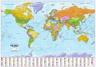
This map is updated in response to the continuing emergence of new nations following the decline of communism. In addition to the independent republics of the former Soviet Union and the states of Croatia, Slovenia and Bosnia-Herzegovina, this edition shows the splitting of Macedonia.
This map is updated in response to the continuing emergence of new nations following the decline of communism. In addition to the independent republics of the former Soviet Union and the states of Croatia, Slovenia and Bosnia-Herzegovina, this edition shows the splitting of Macedonia from the remnants of the Yugoslav Federation and the creation of two states in January 1993 - Czech Republic and Slovakia - from Czechoslovakia. The names of the major cities and international physical features are shown in English and not the local language, for example, Warsaw not Warszawa, Ural Mountains and not Uralskiy Khrebet. This makes the map more accessible to the general reader who needs an up-to-date map to follow reports of world events in newspapers, on radio and television. The mapping is politically coloured to show countries clearly.
This map is updated in response to the continuing emergence of new nations following the decline of communism. In addition to the independent republics of the former Soviet Union and the states of Croatia, Slovenia and Bosnia-Herzegovina, this edition shows the splitting of Macedonia from the remnants of the Yugoslav Federation and the creation of two states in January 1993 - Czech Republic and Slovakia - from Czechoslovakia. The names of the major cities and international physical features are shown in English and not the local language, for example, Warsaw not Warszawa, Ural Mountains and not Uralskiy Khrebet. This makes the map more accessible to the general reader who needs an up-to-date map to follow reports of world events in newspapers, on radio and television. The mapping is politically coloured to show countries clearly.
| Erscheint lt. Verlag | 7.6.1993 |
|---|---|
| Zusatzinfo | four colours on one side |
| Verlagsort | London |
| Sprache | englisch |
| Maße | 148 x 212 mm |
| Gewicht | 120 g |
| Themenwelt | Reisen ► Karten / Stadtpläne / Atlanten ► Welt / Arktis / Antarktis |
| ISBN-10 | 0-7230-0608-3 / 0723006083 |
| ISBN-13 | 978-0-7230-0608-4 / 9780723006084 |
| Zustand | Neuware |
| Haben Sie eine Frage zum Produkt? |
Mehr entdecken
aus dem Bereich
aus dem Bereich
1:30 Mio. mit Posterleisten, mit Oberflächenlaminat
Karte (gerollt) (2023)
INTERKART Landkarten & Globen (Verlag)
25,90 €


