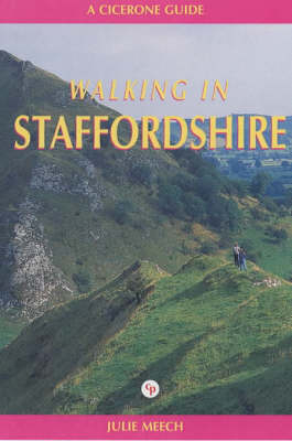
Walking in Staffordshire
Cicerone Press (Verlag)
978-1-85284-317-5 (ISBN)
- Titel ist leider vergriffen;
keine Neuauflage - Artikel merken
North of Birmingham, south of Manchester, west of the Pennines, east of the M6 - Staffordshire disguises its potential as a walking area, a potential that is surprisingly broad. From the protected wilderness of Cannock Chase in the south to the beautiful and remote Shropshire Peak in the north, the gentle hills of Ashbourne and Burton in the east, the heartland of England's canal heritage in its far south, and the glories of Lichfield and its cathedral, "Staffordshire" is endowed with a wide range of walking potential and is readily accessible from the east and west Midlands, the north-west and even Yorkshire.
Key to Maps Walk Start Points Introduction The Staffordshire Countryside Staffordshire Moorlands Cannock Chase South Staffordshire Natural History Staffordshire Wildlife Trust The Woodland Trust Notes for Walkers How to Use this Guide Long-distance and Medium-distance Paths Problem Footpaths A Country Code Further Information Public Transport Getting to Staffordshire Getting Around Staffordshire The Walks Walk 1 Three Shire Heads Walk 2 Flash and Hollinsclough Walk 3 Flash and Washgate Bridge Walk 4 Flash to Leek via the Roaches Walk 5 Upper Hulme and the Roaches Walk 6 Rushton Spencer and Lud's Church Walk 7 Longnor and Chrome Hill Walk 8 Longnor to Hartington Walk 9 Hartington, Sheen and Brund Walk 10 Hartington and Alstonefield Walk 11 Alstonefield and Wetton Walk 12 Warslow, Grindon and Wetton Walk 13 Grindon and Waterfall Walk 14 Rushton Spencer to Leek via Rudyard Lake Walk 15 Biddulph to Kidsgrove via Mow Cop Walk 16 Cheddleton Walk 17 Cheddleton, Consall Nature Park and Consallforge Walk 18 Kingsley, Froghall and Whiston Walk 19 Kingsley, Far Kingsley Banks and Consall Wood Walk 20 Kingsley, Hazlescross and Booth's Wood Walk 21 Alton and Farley Walk 22 Alton to Kingsley Walk 23 Barlaston and Downs Banks Walk 24 Stone and Downs Banks Walk 25 Norbury Junction and Hollies Common Walk 26 Milford Common and TixallWalk 27 Milford Common and Sherbrook Valley Walk 28 Rugeley, Bishton and Colton Walk 29 Rugeley to Hednesford Walk 30 Hednesford and Brindley Heath Walk 31 Hednesford Hills and Castle Ring Walk 32 Alrewas and Lichfield Walk 33 Tamworth and Alvecote Pools Walk 34 Pelsall and Little Wyrley Walk 35 Wombourne Walk 36 Kinver Edge and Sheepwalks Walk 37 Kinver, Enville and The Million Walk 38 Stourton Walk 39 The Stourbridge Canal Walk 40 Hagley, Iverley and Whittington Bibliography Appendix 1: Bus Services and Ticket Information Appendix 2: Table of Route Distances
| Erscheint lt. Verlag | 30.6.2000 |
|---|---|
| Reihe/Serie | County S. |
| Zusatzinfo | Laminated Cover |
| Verlagsort | Kendal |
| Sprache | englisch |
| Maße | 116 x 172 mm |
| Themenwelt | Sachbuch/Ratgeber ► Sport |
| Reiseführer ► Europa ► Großbritannien | |
| ISBN-10 | 1-85284-317-9 / 1852843179 |
| ISBN-13 | 978-1-85284-317-5 / 9781852843175 |
| Zustand | Neuware |
| Haben Sie eine Frage zum Produkt? |
aus dem Bereich


