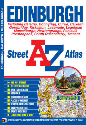
Edinburgh Street Atlas
Seiten
2018
|
9th Revised edition
Geographers' A-Z Map Co Ltd (Verlag)
978-1-84348-914-6 (ISBN)
Geographers' A-Z Map Co Ltd (Verlag)
978-1-84348-914-6 (ISBN)
- Titel erscheint in neuer Auflage
- Artikel merken
Zu diesem Artikel existiert eine Nachauflage
This A-Z map of Edinburgh is a full colour street atlas which also includes a places of interest guide. This publication features 45 pages of continuous street mapping which extends to include:
•South Queensferry
Leith
Prestonpans
Tranent
Musselburgh
Dalkeith
Bonnyrigg
Loanhead
Gorebridge
Penicuik
Balerno
Edinburgh Airport
In addition, there is a large scale city centre map of Edinburgh.
Postcode districts, one-way streets, park and ride sites and safety camera locations with their maximum speed are also featured on the mapping.
The Places of Interest Guide is both informative and helpful, highlighting the city's major tourist attractions and the world famous Edinburgh Festival. A diagrammatic map of the Rail Connections and Trams for Edinburgh (under construction) is also featured.
The index section lists streets, selected flats, walkways and places of interest, junction, place, area and station names, New Edinburgh Tramway stops (under construction), hospitals and hospices covered by this atlas.
This atlas is ideal not only for navigating around Edinburgh, but for exploring this historic city.
Britain’s leading street map publisher providing cartographic services, digital data products and paper mapping publications (including Street Atlases, Visitors Guides, Great Britain Road Atlases and The Adventure Atlas).
| Erscheint lt. Verlag | 8.8.2018 |
|---|---|
| Reihe/Serie | A-Z Street Atlas |
| Sprache | englisch |
| Themenwelt | Reisen ► Karten / Stadtpläne / Atlanten ► Europa |
| ISBN-10 | 1-84348-914-7 / 1843489147 |
| ISBN-13 | 978-1-84348-914-6 / 9781843489146 |
| Zustand | Neuware |
| Haben Sie eine Frage zum Produkt? |
Mehr entdecken
aus dem Bereich
aus dem Bereich
Buch | Spiralbindung (2024)
Freytag-Berndt und ARTARIA (Verlag)
29,90 €


