Atlas of the Great Irish Famine
New York University Press (Verlag)
978-0-8147-7148-8 (ISBN)
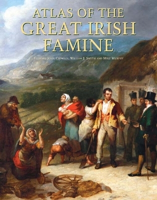
The Great Irish Famine is the most pivotal event in modern Irish history, with implications that cannot be underestimated. Over a million people perished between 1845-1852, and well over a million others fled to other locales within Europe and America. By 1850, the Irish made up a quarter of the population in Boston, New York City, Philadelphia, and Baltimore. The 2000 US census had 41 million people claim Irish ancestry, or one in five white Americans. Atlas of the Great Irish Famine (1845-52) considers how such a near total decimation of a country by natural causes could take place in industrialized, 19th century Europe and situates the Great Famine alongside other world famines for a more globally informed approach.
The Atlas seeks to try and bear witness to the thousands and thousands of people who died and are buried in mass Famine pits or in fields and ditches, with little or nothing to remind us of their going. The centrality of the Famine workhouse as a place of destitution is also examined in depth. Likewise the atlas represents and documents the conditions and experiences of the many thousands who emigrated from Ireland in those desperate years, with case studies of famine emigrants in cities such as Liverpool, Glasgow, New York and Toronto.
The Atlas places the devastating Irish Famine in greater historic context than has been attempted before, by including over 150 original maps of population decline, analysis and examples of poetry, contemporary art, written and oral accounts, numerous illustrations, and photography, all of which help to paint a fuller picture of the event and to trace its impact and legacy. In this comprehensive and stunningly illustrated volume, over fifty chapters on history, politics, geography, art, population, and folklore provide readers with a broad range of perspectives and insights into this event.
John Crowley is Lecturer in the Department of Geography, University College Cork. He is co-editor of Atlas of the Great Irish Famine, the Atlas of Cork City and co-author of The Iveragh Peninsula: A Cultural Atlas of the Ring of Kerry with John Sheehan. William J. Smyth is Emeritus Professor (and former Department Chair) of Geography at University College Cork. He is author of Map-making, Landscapes and Memory: A Geography of Colonial and Early Modern Ireland, co-editor of Common Ground: Essays on the Historical Geography of Ireland, and editor of the journal Irish Geography. Mike Murphy has been cartographer at the Department of Geography, University College Cork for over twenty-five years. He has worked on the Atlas of the Great Irish Famine, Atlas of Cork City (2005) and The Iveragh Peninsula: A Cultural Atlas of the Ring of Kerry (2009).
| Zusatzinfo | 50 Illustrations, color, 50 black and white illustrations |
|---|---|
| Verlagsort | New York |
| Sprache | englisch |
| Maße | 235 x 292 mm |
| Gewicht | 3697 g |
| Themenwelt | Reisen ► Karten / Stadtpläne / Atlanten ► Welt / Arktis / Antarktis |
| Schulbuch / Wörterbuch ► Lexikon / Chroniken | |
| Geisteswissenschaften ► Geschichte ► Regional- / Ländergeschichte | |
| ISBN-10 | 0-8147-7148-3 / 0814771483 |
| ISBN-13 | 978-0-8147-7148-8 / 9780814771488 |
| Zustand | Neuware |
| Haben Sie eine Frage zum Produkt? |
aus dem Bereich


