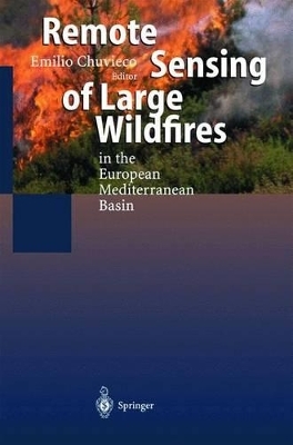
Remote Sensing of Large Wildfires
In the European Mediterranean Basin
Seiten
1999
Springer Berlin (Hersteller)
978-3-540-65767-5 (ISBN)
Springer Berlin (Hersteller)
978-3-540-65767-5 (ISBN)
- Titel ist leider vergriffen;
keine Neuauflage - Artikel merken
The book gives a systematic review of the different applications of remote sensing and geographical information system techniques in research and management of forest fires. The authors have been involved in this topic of research for several years, resulting in more than 100 papers in highly rated journals and proceedings. The book also benefits from data generated within the Megafires project, founded under the DG-XII of the European Union. Most of the contributors to this book have been involved in the Megafires project, and therefore a clear integration of research and experience is provided. New data from fires affecting European countries between 1991 and 1997 are included as well as satellite images and auxiliary cartographic information.
TOC: Introduction.- The Role of Fire in European Mediterranean Ecosystems.- Short-Term Fire Risk: Foliage Moisture Content Estimation from Satellite Data.- Meteorological Fire Danger Indices and Remote Sensing.- Integrated Fire Risk Mapping.- Fire Detection and Fire Growth Monitoring Using Satellite Data.- Spectral Characterisation and Discrimination of Burnt Areas.- Regional Scale Burnt Area Mapping in Southern Europe Using NOAA-AVHRR 1 km data.- Burnt Land Mapping at Local Scale.- References.
TOC: Introduction.- The Role of Fire in European Mediterranean Ecosystems.- Short-Term Fire Risk: Foliage Moisture Content Estimation from Satellite Data.- Meteorological Fire Danger Indices and Remote Sensing.- Integrated Fire Risk Mapping.- Fire Detection and Fire Growth Monitoring Using Satellite Data.- Spectral Characterisation and Discrimination of Burnt Areas.- Regional Scale Burnt Area Mapping in Southern Europe Using NOAA-AVHRR 1 km data.- Burnt Land Mapping at Local Scale.- References.
Aus dem Inhalt:
Introduction.- The Role of Fire in European Mediterranean Ecosystems.- Short-Term Fire Risk: Foliage Moisture Content Estimation from Satellite Data.- Meteorological Fire Danger Indices and Remote Sensing.- Integrated Fire Risk Mapping.- Fire Detection and Fire Growth Monitoring Using Satellite Data.- Spectral Characterisation and Discrimination of Burnt Areas.- Regional Scale Burnt Area Mapping in Southern Europe Using NOAA-AVHRR 1 km data.- Burnt Land Mapping at Local Scale.- References.
| Zusatzinfo | 45 figs., 16 Color Plates, 33 tabs. 1 CD-ROM |
|---|---|
| Sprache | englisch |
| Gewicht | 520 g |
| Einbandart | gebunden |
| Schlagworte | Brand • Fernerkundung • Feuer |
| ISBN-10 | 3-540-65767-3 / 3540657673 |
| ISBN-13 | 978-3-540-65767-5 / 9783540657675 |
| Zustand | Neuware |
| Haben Sie eine Frage zum Produkt? |