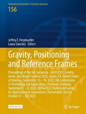
Gravity, Positioning and Reference Frames
Springer International Publishing (Verlag)
978-3-031-63854-1 (ISBN)
This open access volume contains a selection of papers presented at three different IAG Symposia held in 2022: GGHS2022 - Gravity, Geoid, and Height Systems 2022, Austin, TX, United States of America, September 12 - 14, 2022; IAG Commission 4 - Positioning and Applications, Potsdam, Germany, September 5 - 8, 2022; and REFAG2022 - Reference Frames for Applications in Geosciences, Thessaloniki, Greece, October 17 - 20, 2022. Two of these three conferences were planned for 2020 or 2021, but had to be postponed due to the COVID19 pandemic. They therefore became an important opportunity for the global geodesy community to rebuild professional networks and to resume face-to-face interaction. Scientists from around the world were delighted to once again gather together to present their research progress and findings, and discuss scientific issues.
GGHS2022: Gravity Field.- A Comparison of Pointwise and Levelling Assisted Regional Realisations of IHRS With a Case Study Over Sweden.- New Tidal Analysis of Superconducting Gravimeter Records at Metsähovi, Finland.- Development of the National Gravimetric Geoid Model for the Kingdom of Saudi Arabia.- Comparisons of Absolute Gravimeters as a Key Component of the International Terrestrial Gravity Reference Frame (ITGRF) Shown on the Example of the WET-CAG2021 at Wettzell, Germany.- Newly Acquired Gravity Data in Support of the GeoNetGNSS CORS Network in Northern Greece.- Strapdown Airborne Gravimetry Based on Aircrafts and UAVs: Postprocessing Algorithms and New Results.- Estimation of Temporal Variations in the Earth's Gravity Field Using Novel Optical Clocks Onboard of Low Earth Orbiters.- Hybrid Geoid Modeling for the Kingdom of Saudi Arabia.- IAG Commission 4: Positioning and Applications.- Almost-Instantaneous PPP-RTK Without Atmospheric Corrections.- Multi-GNSS 1 Tomography: Case Study of the July 2021 Flood in Germany.- Quantum Diamond Magnetometry for Navigation in GNSS Denied Environments.- Feasibility of CSAC-Assisted GNSS Receiver Fingerprinting.- On the Impact of GNSS Receiver Settings on the Estimation of Codephase Center Corrections.- Quality Control Methods for Climate Applications of Geodetic Tropospheric Parameters.- REFAG2022: Reference Frames.- Impact of Coordinate- and Tropospheric Ties on the Rigorous Combination of GNSS and VLBI.- How Do Atmospheric Tidal Loading Displacements Vary Temporally as well as Across Different Weather Models?.- Alternative Strategies for the Optimal Combination of GNSS and Classical Geodetic Networks: A Case-study in Greece.- A Concept of Precise VLBI/GNSS Ties with Micro-VLBI.- Status of the SIRGAS Reference Frame: Recent Developments and New Challenges.- A Review of Space Geodetic Technique Seasonal Displacements Based on ITRF2020 Results.- Validation of Reference Frame Consistency of GNSS Service Products.- Intra-Technique Combination of VLBI Intensives and Rapid Data to Improve the Temporal Regularity and Continuity of the UT1-UTC Series.- Automatic Determination of the SLR Reference Point at Côte d'Azur Multi-technique Geodetic Observatory.- The K-band (24 GHz) Celestial Reference Frame Determined from Very Long Baseline Interferometry Sessions Conducted over the Past 20 Years.- VGOS VLBI Intensives Between macgo12m and wettz13s for the Rapid Determination of UT1-UTC.- Correcting Non-tidal Surface Loading in GNSS repro3 and Comparison with ITRF2020.- Upgrading the Metsähovi Geodetic Research Station.- Assessing the Potential of VLBI Transmitters on Next Generation GNSS Satellites for Geodetic Products.- Potential of Lunar Laser Ranging for the Determination of Earth Orientation Parameters.
| Erscheinungsdatum | 27.07.2024 |
|---|---|
| Reihe/Serie | International Association of Geodesy Symposia |
| Zusatzinfo | XIII, 252 p. 144 illus., 137 illus. in color. |
| Verlagsort | Cham |
| Sprache | englisch |
| Maße | 210 x 279 mm |
| Themenwelt | Naturwissenschaften ► Geowissenschaften ► Geografie / Kartografie |
| Naturwissenschaften ► Geowissenschaften ► Geologie | |
| Naturwissenschaften ► Geowissenschaften ► Geophysik | |
| Schlagworte | Atmospheric investigations using space geodetic techniques • Geodetic reference frames and Earth science applications • Geodetic sensor and information fusion • Global and local/regional gravity field modelling • Gravity observations and methods • Height systems and vertical datum unification • Mass transport and climate-relevant processes • Navigation and guidance of platforms • open access • Satellite altimetry and applications • Terrestrial and satellite-based positioning system development |
| ISBN-10 | 3-031-63854-9 / 3031638549 |
| ISBN-13 | 978-3-031-63854-1 / 9783031638541 |
| Zustand | Neuware |
| Haben Sie eine Frage zum Produkt? |
aus dem Bereich


