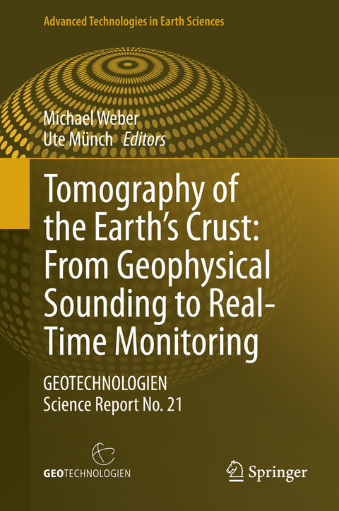
Tomography of the Earth’s Crust: From Geophysical Sounding to Real-Time Monitoring
Springer International Publishing (Verlag)
978-3-319-04204-6 (ISBN)
The research work on the topic of ''Tomography of the Earth's Crust: From Geophysical Sounding to Real-Time Monitoring'' has focused on the development of cross-scale multiparameter methods and their technological application together with the development of innovative field techniques. Seismic wave field inversion theory, diffusion and potential methods were developed and optimized with respect to cost and benefit aspects.
This volume summarizes the scientific results of nine interdisciplinary joint projects funded by the German Federal Ministry of Education and Research in the framework of the Research and Development Program GEOTECHNOLOGIEN.
Highlights and innovations presented cover many length scales and involve targets ranging from applications in the laboratory, to ground water surveys of heterogeneous aquifer, geotechnical applications like tunnel excavation, coal mine and CO2 monitoring and the imaging and monitoring of tectonic and societally relevant objects as active faults and volcanoes.
To study these objects, the authors use the full spectrum of geophysical methods (ultrasonics, seismic and seismology, electromagnetics, gravity, and airborne) in combination with new methods like seismic interferometry, diffuse wave field theory and full-wave-form inversion in 3D and partially also in 4D.
Geophysical Sounding to Real-Time Monitoring'' has focused on the development of cross-scale multiparameter methods and their technological application together with the development of innovative field techniques. Seismic wave field inversion theory, diffusion and potential methods were developed and optimized with respect to cost and benefit aspects.
This volume summarizes the scientific results of nine interdisciplinary joint projects funded by the German FederalMinistry of Education and Research in the framework of the Research and Development Program GEOTECHNOLOGIEN.
Highlights and innovations presented cover many length scales and involve targets ranging from applications in the laboratory, to ground water surveys of heterogeneous aquifer, geotechnical applications like tunnel excavation, coal mine and CO2 monitoring and the imaging and monitoring of tectonic and societally relevant objects as active faults and volcanoes.
To study these objects, the authors use the full spectrum of geophysical methods (ultrasonics, seismic and seismology, electromagnetics, gravity, and airborne) in combination with new methods like seismic interferometry, diffuse wave field theory and full-wave-form inversion in 3D and partially also in 4D.
2 monitoring and the imaging and monitoring of tectonic and societally relevant objects as active faults and volcanoes.
To study these objects, the authors use the full spectrum of geophysical methods (ultrasonics, seismic and seismology, electromagnetics, gravity, and airborne) in combination with new methods like seismic interferometry, diffuse wave field theory and full-wave-form inversion in 3D and partially also in 4D.
Dipl.-Forstwirt Dr. Michael Weber, Lehrstuhl für Waldbau und Forsteinrichtung, München.
4D Spectral Electrical Impedance Tomography (EIT) a diagnostic imaging tool for the characterization of subsurface structures and processes (4D-EIT).- From Airborne Data Inversion to In-Depth Analysis (AIDA).- Monitoring and Imaging based on Interferometric Concepts (MIIC).- Mining Environments: Continuous Monitoring and Simultaneous Inversion (MINE).- Three-dimensional Multi-Scale and Multi-Method Inversion to Determine the Electrical Conductivity Distribution of the Subsurface Using Parallel Computing Architectures (Multi-EM).- Multi-Scale S-Wave Tomography for Exploration and Risk Assessment of Development Sites (MuSaWa).- Seismic Observations for Underground Development (SOUND).- Toolbox for Applied Seismic Tomography (TOAST).- Tomographic Methods in Hydrogeology (TOMOME).
| Erscheint lt. Verlag | 28.2.2014 |
|---|---|
| Reihe/Serie | Advanced Technologies in Earth Sciences |
| Zusatzinfo | X, 176 p. 84 illus., 28 illus. in color. |
| Verlagsort | Cham |
| Sprache | englisch |
| Maße | 155 x 235 mm |
| Gewicht | 450 g |
| Themenwelt | Naturwissenschaften ► Geowissenschaften ► Geologie |
| Naturwissenschaften ► Geowissenschaften ► Geophysik | |
| Schlagworte | Airborne and Terrestrial Data • Geoelectric • Geotechnologien • Induced Seismicity • Interferometric Concepts • Tomography |
| ISBN-10 | 3-319-04204-1 / 3319042041 |
| ISBN-13 | 978-3-319-04204-6 / 9783319042046 |
| Zustand | Neuware |
| Haben Sie eine Frage zum Produkt? |
aus dem Bereich
